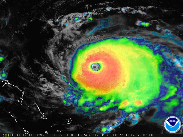
Updated Sept. 1, 9:40 am ET (1340 GMT): Hurricane Dorian is now a monster Category 5 storm as it nears the Abacos Islands and Grand Bahama Island.
As the storm swells closer to land, satellites operated by NASA and the National Oceanic and Atmospheric Administration (NOAA) continue to track its movement and progress. You can see some of the images from those satellite observations below, which have been shared on social media.
Related: NASA Sees Hurricane Dorian from Space Station (Video)
September 1
NOAA Satellites
✔@NOAASatellites
NOAA’s #GOESEast spotted lightning in the eye of #HurricaneDorian this morning. The now catastrophic Cat. 5 storm is expected to bring life-threatening storm surge and very heavy rainfall to the Abaco Islands and Grand Bahama through Monday. More: http://go.usa.gov/xVKrj

August 31
NOAA Satellites
✔@NOAASatellites
Severe #HurricaneDorian, seen in this “sandwich loop” from NOAA’s #GOESEast, is heading for the northwestern #Bahamas where the Cat. 4 storm is expected to bring life-threatening storm surge and devastating winds. Latest updates from the @NHC_Atlantic: http://nhc.noaa.gov/
NASA
✔@NASA
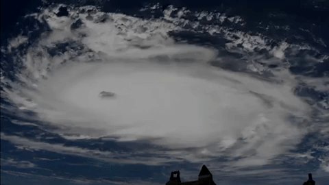
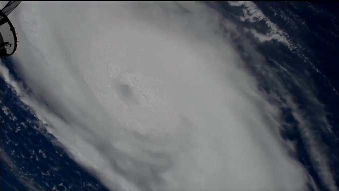
Cameras outside the @Space_Station captured views of #HurricaneDorian at 11:28am ET as it churned over the Atlantic Ocean. With winds of 145 mph, the storm may approach Category 5 hurricane status, according to the National Hurricane Center. Take a look: https://go.nasa.gov/2NJz7B4

National Hurricane Center
✔@NHC_Atlantic
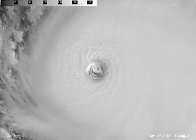
High-resolution visible imagery over the eye of #Dorian is stunning this morning. This is a special view of 30-second @NOAA high-resolution visible imagery that forecasters use. Catch the latest on this hurricane’s forecast at http://hurricanes.gov

NOAA Satellites
✔@NOAASatellites
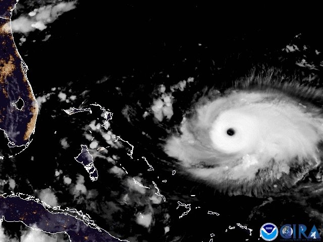
The wide eye of #HurricaneDorian is visible even from the #GOESEast perspective 22,300 miles away in space. While some fluctuations in intensity are possible, this major Cat. 4 storm is expected to remain a powerful #hurricane during the next few days. http://go.usa.gov/xVByS
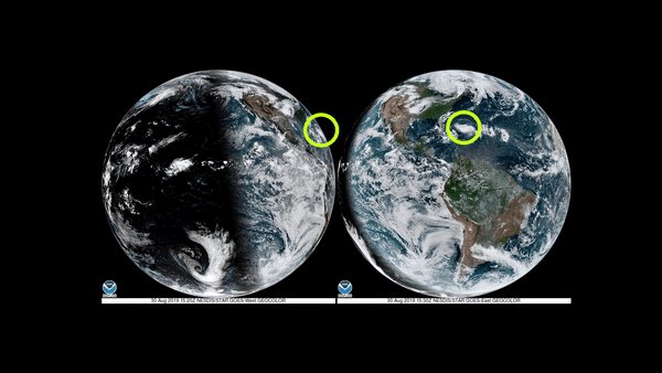
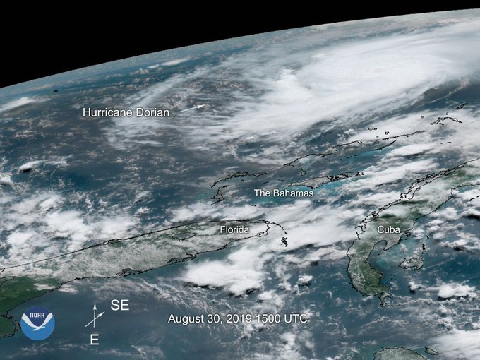
August 30
NOAA Satellites
✔@NOAASatellites
On this #FullDiskFriday, both #GOESWest and #GOESEast are keeping a close eye on extremely dangerous #HurricaneDorian from 22,300 miles in space. #Dorian is now a Cat. 3 storm with maximum sustained winds of 115 mph, according to the @NHC_Atlantic. More: http://go.usa.gov/xVB4m
NOAA Satellites
✔@NOAASatellites
Watch as the eye of #HurricaneDorian2019 begins to form in this 1-minute visible loop from NOAA’s #GOESEast. “Dangerous Hurricane #Dorian poses a significant threat to #Florida and the northwestern #Bahamas,” according to the @NHC_Atlantic. Latest: http://go.usa.gov/xVB3K
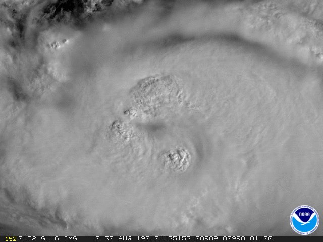
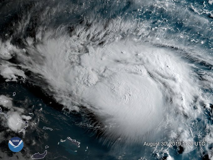
NOAA Satellites
✔@NOAASatellites
Major #HurricaneDorian, seen here by NOAA’s #GOESWest, is now an extremely dangerous Cat. 3 storm. #Dorian is expected to strengthen and “poses a significant threat to #Florida and the northwestern #Bahamas,” according to the @NHC_Atlantic. More: http://go.usa.gov/xVBTg
NASA SPoRT
✔@NASA_SPoRT
Evening RT: Using satellite imagery from the @NASARain Constellation to diagnose the evolution of cloud and precipitation structure in Hurricane #Dorian >>https://go.nasa.gov/2MLO5a2


Intl. Space Station
✔@Space_Station
Cameras outside the space station captured these views of rapidly intensifying #HurricaneDorian at 12:18pm ET on August 30 as it churned over the Atlantic Ocean. For more on NASA’s coverage of #Dorian, visit: http://nasa.gov/press-release/nasa-to-provide-coverage-of-hurricane-dorian ….

NOAA Satellites
✔@NOAASatellites
Take a look at all that lightning! The Geostationary Lightning Mapper aboard NOAA’s #GOESEast captured this view of all the lightning associated with #HurricaneDorian2019 in the morning hours of Aug. 30, 2019. Follow the storm’s path here: http://go.usa.gov/xVZu9
NOAA Satellites
✔@NOAASatellites
Hurricane #Dorian, seen here by NOAA’s #GOESEast, is now a Cat. 2 storm with maximum sustained winds of 110 mph. A #HurricaneWatch is now in effect for the northwestern #Bahamas as the storm slowly churns across the western #Atlantic. More: http://go.usa.gov/xVZMX
NASA Earth
✔@NASAEarth
TEMPEST-D, a weather-observing CubeSat, used its miniaturized radio-wave-based instrument to see through the clouds, showing areas with strong rain and moisture being pulled into the storm.
Green = Moisture spiraling into the storm’s center
Yellow to Pink = Intense rainfall


NASA Earth
✔@NASAEarth
NOAA Satellites
✔@NOAASatellites
Hurricane #Dorian, seen here by NOAA’s #GOESEast, is now a Cat. 2 storm with maximum sustained winds of 110 mph. A #HurricaneWatch is now in effect for the northwestern #Bahamas as the storm slowly churns across the western #Atlantic. More: http://go.usa.gov/xVZMX
August 29
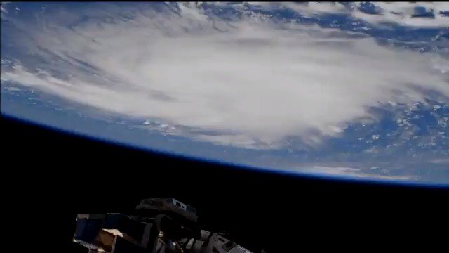
Intl. Space Station
✔@Space_Station
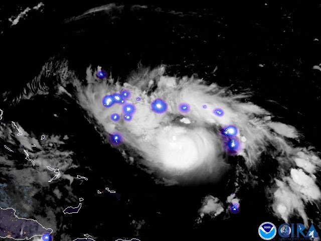
A camera outside the station captured views of Hurricane Dorian at 1:05pm ET today as it churned over the Atlantic Ocean north of Puerto Rico.
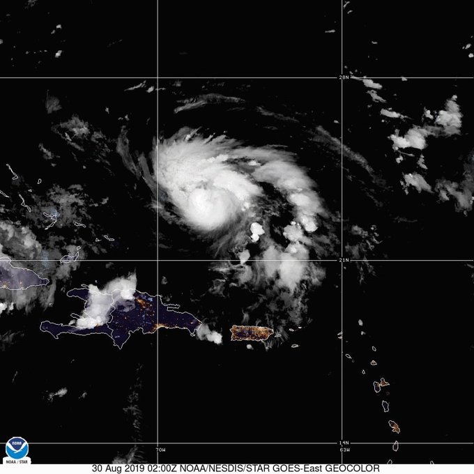
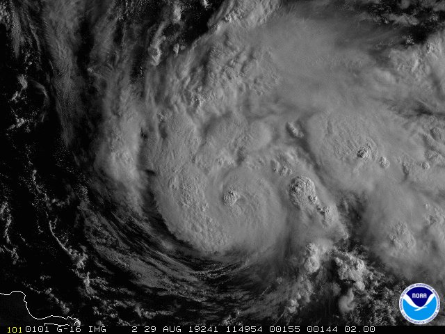
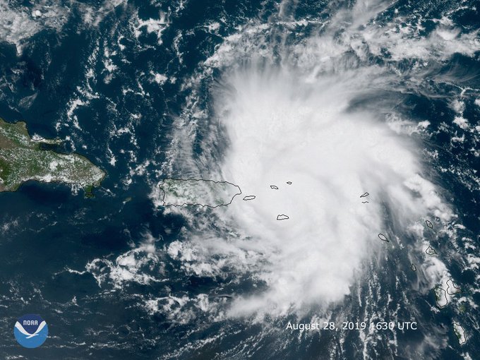
NOAA Satellites PA@NOAASatellitePANEW: This morning’s latest visible satellite animation from #GOES16 of #HurricaneDorian as it moves away from #PuertoRico and the #VI into the open waters of the Atlantic. Updates: @NHC_Atlantic

August 28
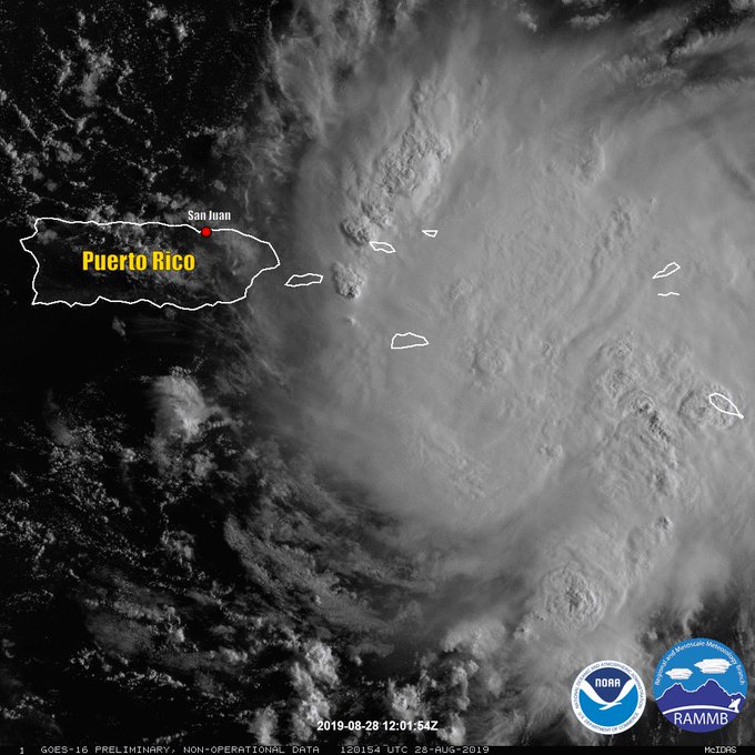
NOAA Satellites PA@NOAASatellitePAThis visible satellite animation from NOAA’s #GOES16 shows #TropicalStormDorian moving closer to the #VirginIslands and #PuertoRico this morning. Get the latest @NHC_Atlantic update here: https://www.nhc.noaa.gov/
UW-Madison CIMSS@UWCIMSS#GOESEast meso-sector is tracking #TropicalStormDorian. View 1-minute imagery of TS #Dorian via multiple #GOES16 bands HT @UW_AOS at http://www.aos.wisc.edu/weather/wx_obs/GOES16_meso2.html …

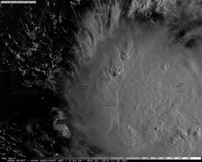
NASA SPoRT
✔@NASA_SPoRT
Latest look at Hurricane #Dorian from @NOAA‘s GOES16. For official information stay tuned to @NHC_Atlantic and local @NWS WFOs.
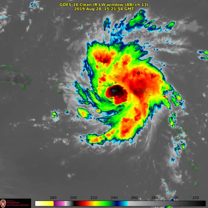
NOAA Satellites
✔@NOAASatellites
Earlier this afternoon #Dorian strengthened to a Cat. 1 #hurricane with maximum sustained winds of 75 mph. NOAA’s #GOESEast spotted the storm moving toward the #VirginIslands, where hurricane warnings are now in effect. Follow the storm’s path here: http://go.usa.gov/xVWkT
August 27
NOAA Satellites
✔@NOAASatellites
Tropical Storm #Dorian, seen in this view from NOAA’s #GOESEast, moved over the Lesser Antilles this morning. While uncertainty remains high, the @NHC_Atlantic says wind and rain from this system could impact the Bahamas and Florida later this week. More: http://go.usa.gov/xVD3A

August 26
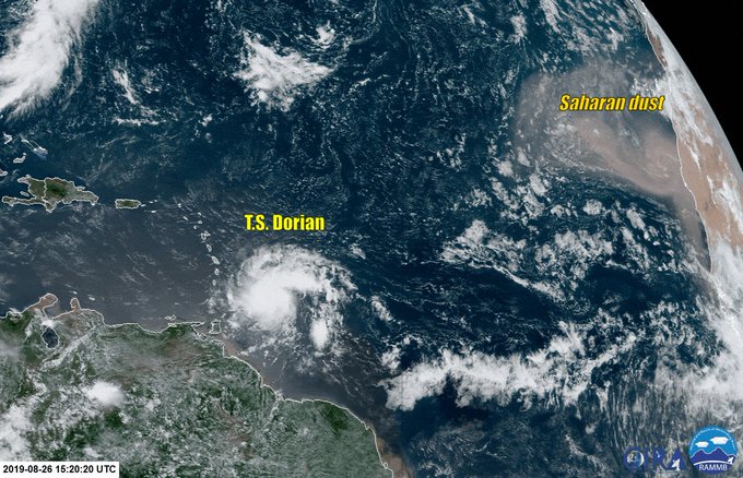
NOAA Satellites PA@NOAASatellitePAAs #TropicalStorm #Dorian spins in the Atlantic, NOAA’s #GOES16 is keeping an eye on it. You can also see the #dust coming off the #SaharaDesert at the top right. Here’s the latest #tropical update: https://www.nhc.noaa.gov/
NOAA Satellites PA@NOAASatellitePA